


Watch this video to learn about sea level rise! Click here to download this video (1920x1080, 46 MB, video/mp4).
Rising sea level is one of the clearest signs of global warming. It's also one of the biggest problems that global warming is causing.
What causes sea level to rise?
There are two main causes of sea level rise and both are due to heat. Glaciers and ice sheets are large masses of ice that sit on the land. As our planet warms, this ice melts and flows into the oceans. More water in the oceans makes sea level higher.
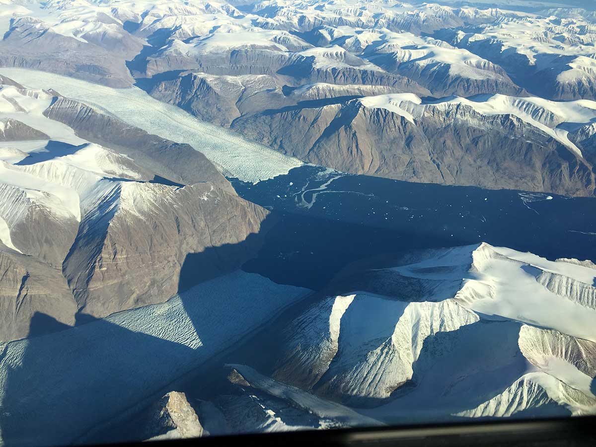
As these glaciers in eastern Greenland melt, the water goes directly into the ocean. This photo was taken from an airplane for NASA's Oceans Melting Greenland mission in Fall 2016. Credit: NASA/JPL-Caltech
Secondly, water expands as it gets warmer. So, warm water takes up more room in our oceans – making sea levels higher.
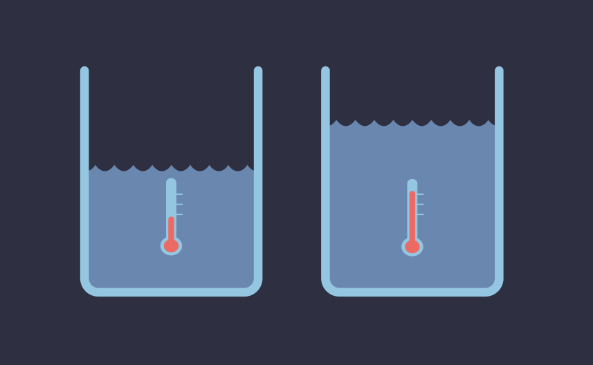
Warm water expands, taking up more room than cold water. This is one reason that a warming planet causes sea level rise. Credit: NASA/JPL-Caltech
These two things combined have raised sea level about 7 to 8 inches (about 16 to 21 centimeters) since 1900. That's a big problem for the millions of people who live in communities near the coast.
How do we know sea level is rising?
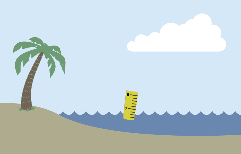
You can't just use a ruler to measure global sea level rise. Credit: NASA/JPL-Caltech
Unfortunately, you can't just put a long ruler into the ocean to measure sea level rise. Sea level varies from place to place. This is because of differences in geography, gravity, temperature, ocean currents and tides.
Oceans cover about 70 percent of the world. So, to know how much sea level is rising all over planet, you'd have to have millions of rulers in millions of different places.
It turns out the best way to measure changes in sea level is from space.
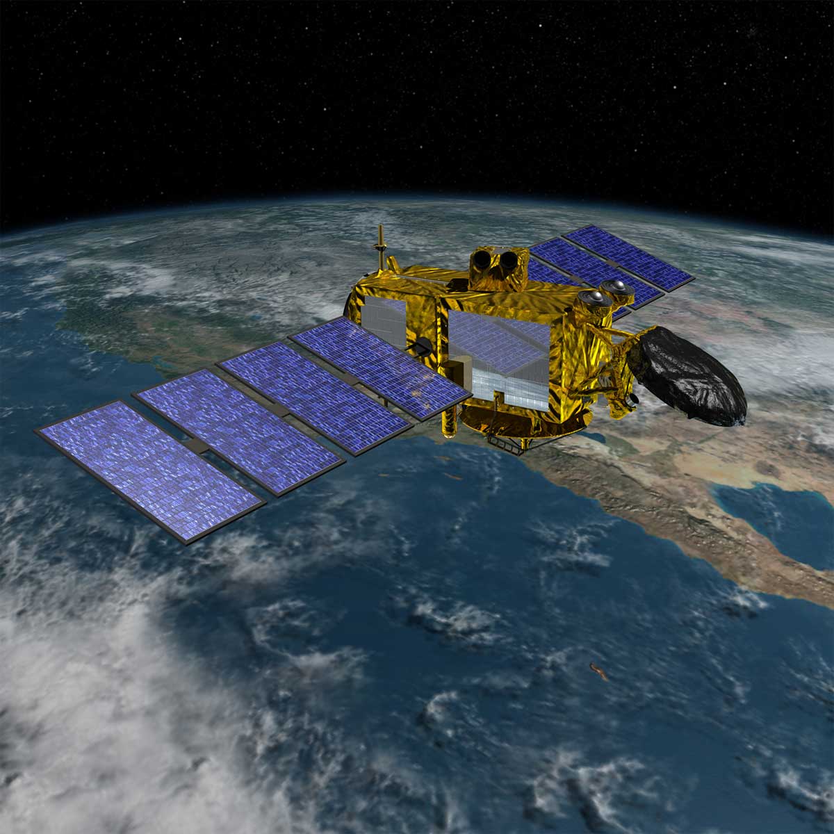
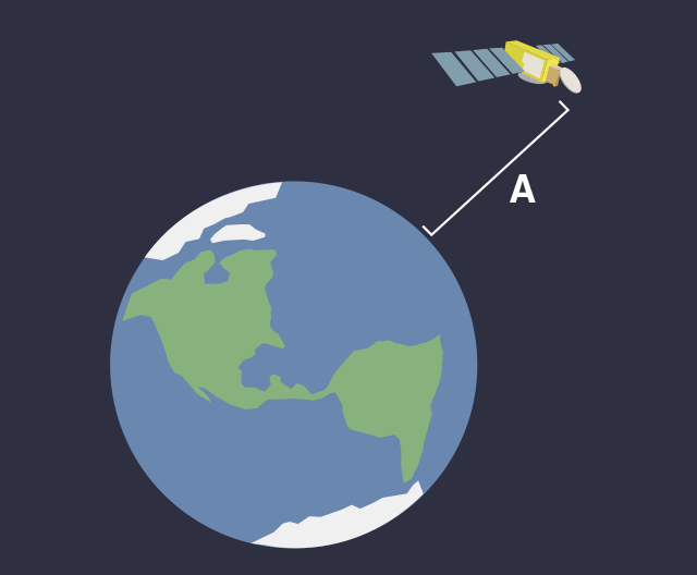
This illustration shows the Jason-3 satellite, which measures the distance from itself to the ocean surface by bouncing a beam of radio waves off the water. Credit: NASA/JPL-Caltech
NASA's Jason-3 satellite carries an instrument called a radar altimeter. It uses radio waves instead of a ruler to measure distances.
Here's how it works. Jason-3 bounces radio waves off the ocean surface. The satellite then times how long it takes for these signals to return. Scientists can use this measurement to calculate the distance between the satellite and the ocean surface in that particular location.
Jason-3 orbits about 800 miles (1,300 kilometers) above Earth. Even from that far away, Jason-3 can measure the distance from itself to the ocean surface to within about one inch (about three centimeters).
Credit: NASA/JPL-Caltech
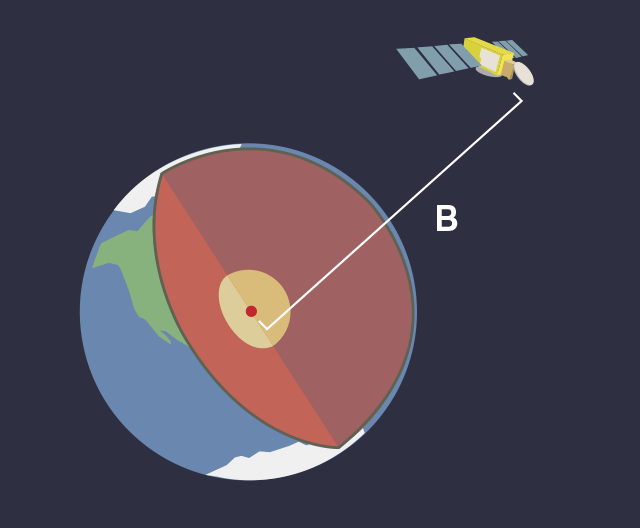
Jason-3 also has instruments that allow scientists to measure the distance from the satellite to the center of Earth.
Credit: NASA/JPL-Caltech
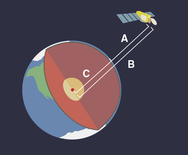
By subtracting the first distance (between the satellite and ocean surface) from the second distance (between the satellite and Earth's center), we can calculate the distance from the ocean surface to Earth's center.
Credit: NASA/JPL-Caltech
The satellite constantly zips over new portions of the planet. In about 10 days, it measures ocean height over the entire Earth. Finding an average of all those measurements gives an average sea level for the whole planet.
During the next 10 days, Jason-3 does it all over again – and again and again, year after year! By seeing how the average distance from the top of the ocean to the center of the Earth increases over time, we can measure how much and how quickly sea level is rising.
Related NASA Missions
Jason-3
Related Resources for Educators
Project: How Melting Ice Causes Sea Level Rise
Stability and Change: Monitoring Sea Level Student Activity
Student Activity: Sea Level Rise By Decade
Data Jigsaw Student Activity: Exploring Sea Level Rise with Others


