


Brrrrr! Why’s It So Cold Outside?
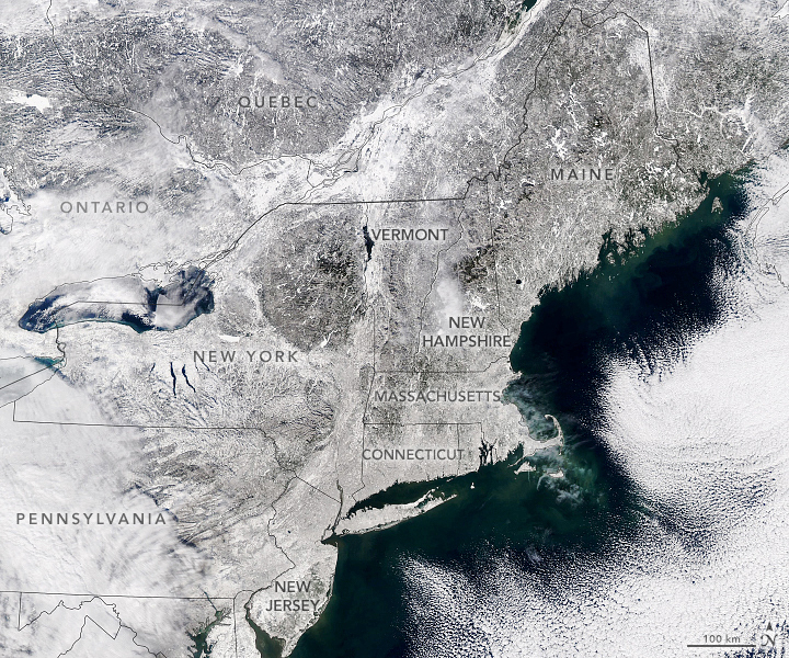
NASA’s Aqua satellite took this image of snow covering the northeastern U.S. in January 2022 after a blizzard traveled through the area. Credit: NASA
Grab your mittens, coat, and hat: winter is back!
Winter for many of us often brings colder temperatures, gray skies, and sometimes snowy days. But in recent years, some winters have felt warmer. In some places, maybe you only needed a winter coat for a few days or weeks. Then in other years, it’s freezing for what feels like weeks on end. What gives?
To answer that, we need to know about the difference between weather and climate.
Weather is what happens day to day: The change in temperatures, cloudy or clear skies, and whether it’s raining or snowing.
Climate is what you get when you put all the weather days together and see what they have in common. This can be over a season or longer, and it can change from place to place. For example, it tends to be hotter in the summer and cooler in winter. Another example is how some places get lots of rain and others do not, like rainforests and deserts.
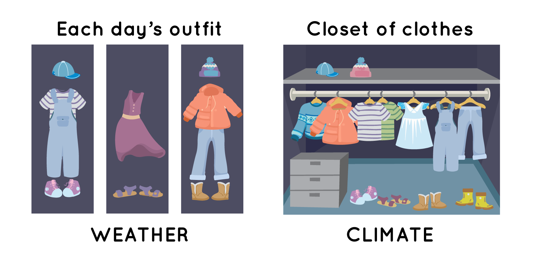
Weather and climate are similar but not the same thing. Think of your clothes. What you wear each day is like the weather. It changes from day to day. However, all of the clothes in your closet for either winter or summer are based on the climate. For example, you may have mostly shorts in your closet for summer and mostly pants for winter. That’s because climate tells us what the weather will be like most days during a season or longer. Credit: NASA/JPL-Caltech
Why does climate matter? Well, when you are talking about global warming, you are actually talking about a change in Earth’s climate. This includes changes in Earth’s temperature, weather patterns, and ocean.
When scientists look at Earth’s temperature each year for the past 100 years or so, they see that it has been getting warmer. Across the planet, this means more days and nights are hotter than they used to be.
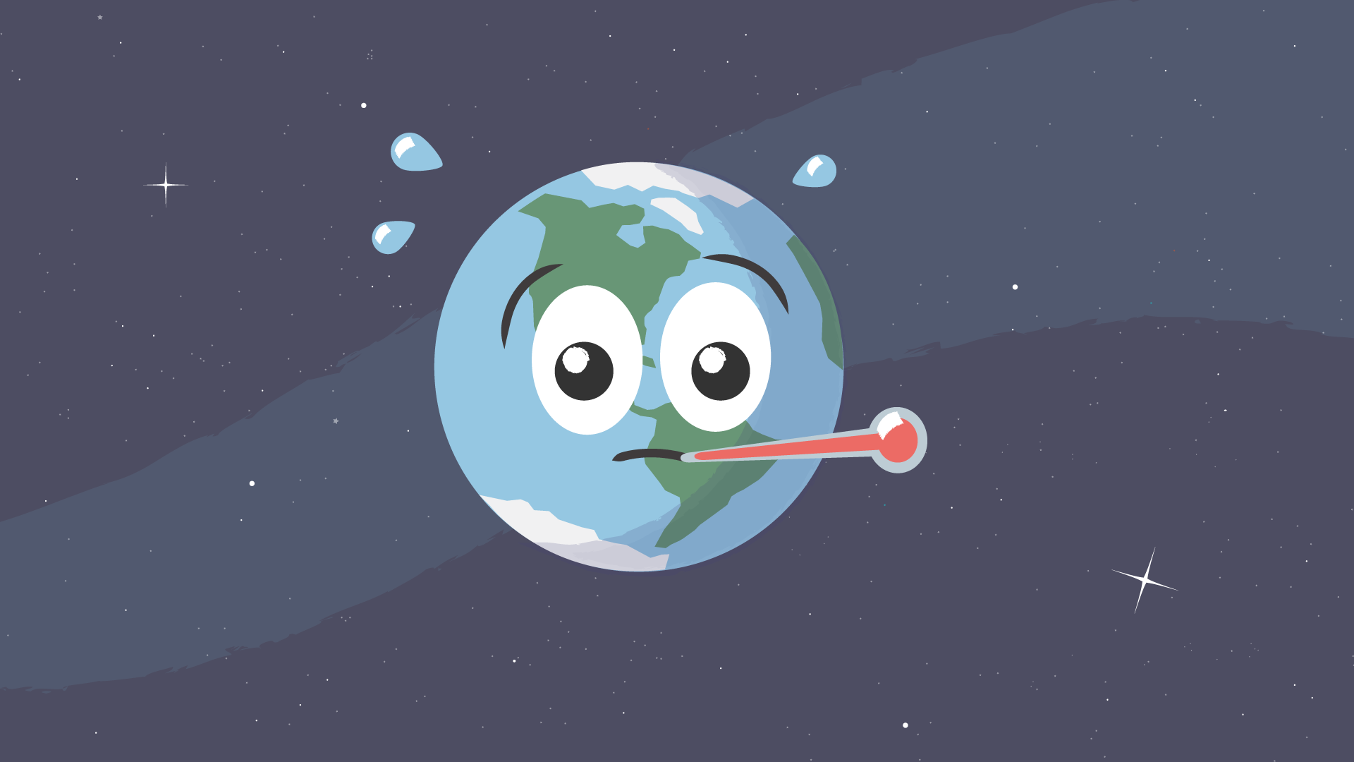
Earth’s temperature is rising, just like a fever. When we burn coal, gas, and oil, it releases greenhouse gases like carbon dioxide (CO2) into the atmosphere. This causes the average temperature of Earth to rise over time. Credit: NASA/JPL-Caltech
However, global warming does not mean that it will never get cold where you live. For many places, a blizzard, snowstorm, or freezing temperatures can and do happen each winter. That’s because weather and climate are different things. And the weather is affected by many things.
For instance, it may seem far away, but the weather and climate in the Arctic can actually affect our weather in the U.S. It can change how much cold air moves south and influence how storms travel.
Some changes in the Arctic can happen naturally, while other changes are because of human-caused climate change. To monitor changes in the Arctic, scientists began measuring its ice and weather in 1979 with satellites. With this information, they found that the area is warming faster than the rest of the planet because of climate change. This change in the Arctic is leading to fewer cold snaps over the U.S. as time goes on.
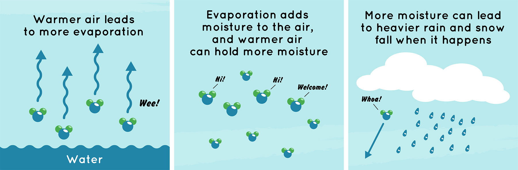
As air temperatures get warmer, it affects the water cycle. Warmer air leads to more evaporation, or the changing of liquid water into a gas. The gas form of water is called water vapor. The evaporation adds moisture to the air, and warmer air can hold more of it. This leads to heavier rain and snow fall when it happens, as there is more water vapor in the air to condense, combine, and fall. Condensation is when a gas (water vapor) turns into a liquid (water droplet). Credit: NASA/JPL-Caltech
There is another way human-caused climate change is impacting cold weather. As the planet warms, the air can hold more moisture. That can lead to heavier snow and rainfall than usual. It can also change patterns for where it rains and snows.
How do we know what’s happening on our planet? Well, satellites and weather stations are keeping track of Earth’s temperatures and more. This provides scientists with important data they need to predict weather and changes to Earth’s climate.
There will likely be fewer cold days in our future due to global warming. That being said, many places will still have at least some cold days in winter. So make sure to hang on to those warm winter coats and long underwear, too!


