


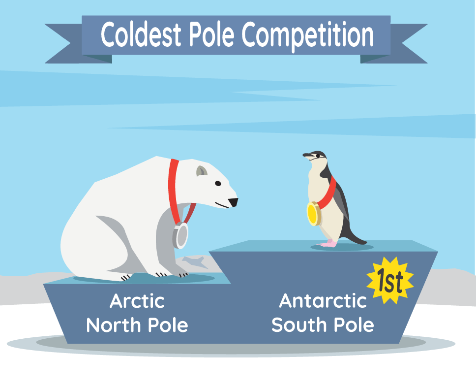
In the competition for Earth’s coldest pole, the South Pole in Antarctica wins. The South Pole is found over icy land, rather than over sea ice, helping to make it colder. Credit: NASA/JPL-Caltech
Both the North and South Pole are very cold because they get very little direct sunlight throughout the year. This has to do with where the poles are located on the sphere-shaped Earth. The North Pole is at the top, and the South Pole is at the bottom.
When you connect the poles with an imaginary line, it is called Earth’s axis. Looking at Earth as it travels, or orbits, around the Sun, the axis is not straight up and down. Instead, it is tilted. This means that sometimes the top of the planet (North Pole) is pointed more at the Sun and sometimes it is pointed away.
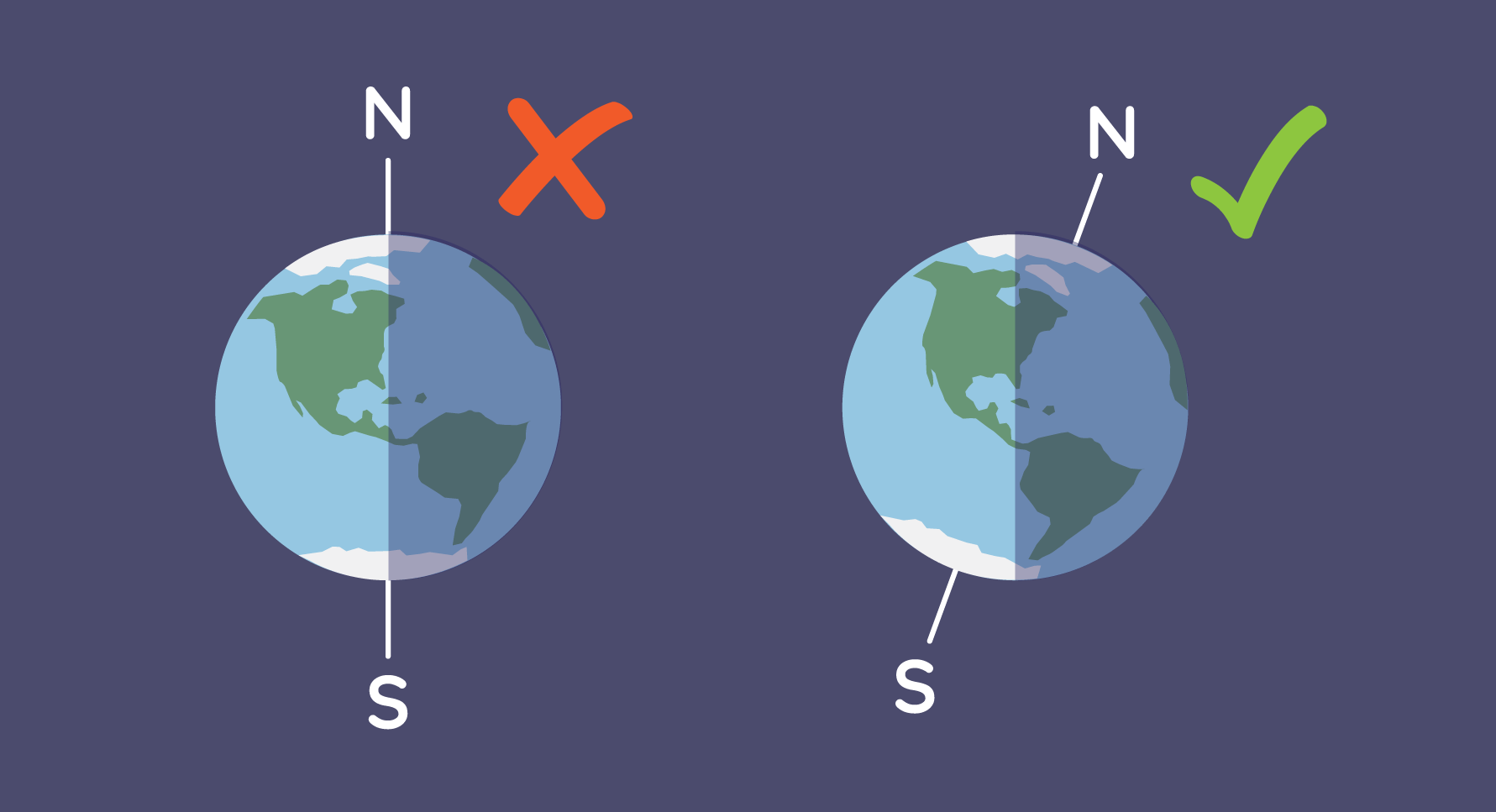
Earth’s axis does not appear straight up and down, but rather is tilted. Credit: NASA/JPL-Caltech
This tilt is the reason for seasons. When the North Pole is pointed toward the Sun, it is summer there. At the same time, the South Pole is pointed away from the Sun, making it winter. As Earth travels around the Sun, the poles switch seasons.
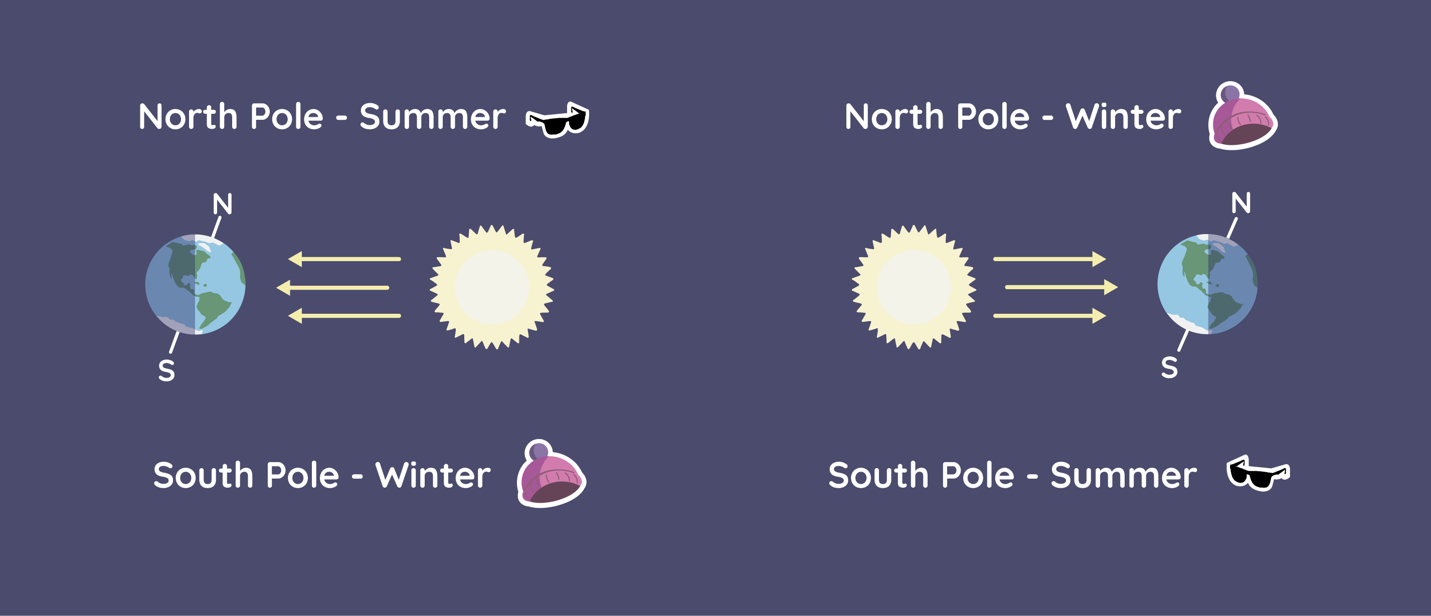
Earth’s tilted axis creates seasons. When the North Pole is pointing toward the sun, there is more sunlight reaching the northern half of the planet, leading to summer. When it is pointing away, there is less sunlight, leading to winter. As the poles are on opposite ends of Earth, they experience opposite timing for the seasons. Credit: NASA/JPL-Caltech
At both poles, the Sun is always low on the horizon. This helps keep the poles cold even in the summer when the Sun is up all day. In winter, the Sun is so far below the horizon that it doesn't come up at all for months at a time. So the days are just like the nights — cold and dark.
Even though the North Pole and South Pole are at opposite ends of the planet, they both get the same amount of sunlight over the year. But take a look at this table of temperatures. What do you see?
| Time of year | Average (mean) temperature | |
| North Pole | South Pole | |
| Summer | 32° F (0° C) | −18° F (−28.2° C) |
| Winter | −40° F (−40° C) | −76° F (−60° C) |
That’s right! The South Pole is a lot colder than the North Pole in both seasons. Why? Well, the poles are “polar opposites” in more than one way. Let’s compare.
What Makes the North Pole Really Cold?
The North Pole sits in the middle of the Arctic Ocean. The Arctic Ocean and the land around it make up the Arctic region.
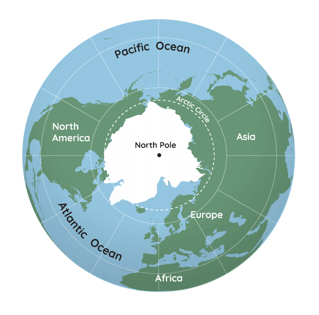
A map of Earth while looking down on the North Pole. The white are areas are places normally covered in ice. In the Arctic, there is sea ice over the ocean. There is also land ice over Greenland. Credit: NASA/JPL-Caltech
It’s cold enough that most of the Arctic Ocean is covered in ice, known as sea ice, for much of the year. That means that the North Pole sits in the middle of sea ice. Since sea ice floats over water, it acts differently than ice over land. That is because the parts of the ocean that are not covered in ice help warm the air. Plus, the temperature of the water below the sea ice changes. These limit how thick the sea ice can grow.
What Makes the South Pole Really, Really Cold?
Heading to the South Pole, we find the opposite. Now we have land surrounded by ocean.
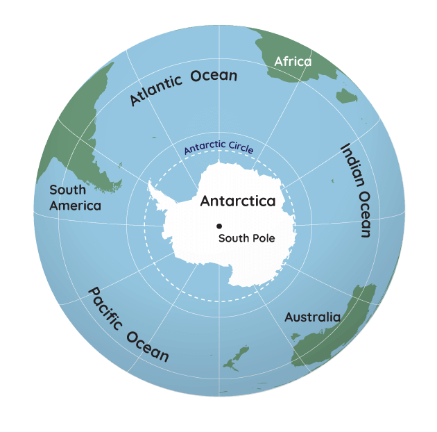
A map of Earth while looking down on the South Pole. The white areas are land covered in ice. Credit: NASA/JPL-Caltech
The continent of Antarctica is dry and high. The ice in Antarctica is super thick — up to 3 miles (5 kilometers)! This ice sheet forms a huge plateau -- a flat surface like a tabletop -- that sits high above sea level.
Antarctica's ice and snow also sits on top of mountains that are very tall and rise high above sea level. Just like mountains in other parts of the world, the higher you climb in Antarctica, the colder the air gets.
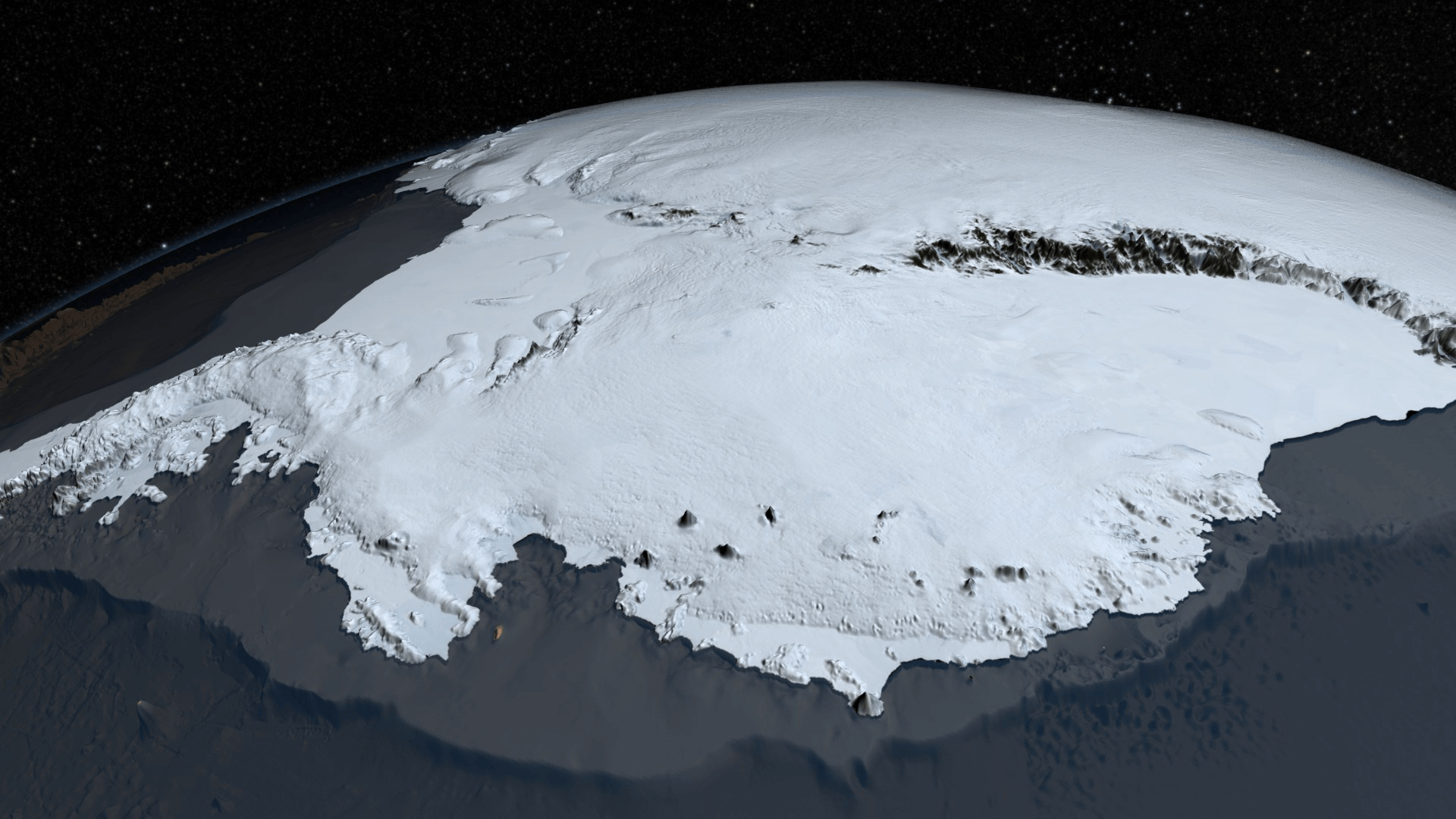
This 3D topographical view of Antarctica gives an idea of its high elevations and mountains with ice that covers them. A topographical map shows the elevation and other features of a land surface in greater detail. Credit: NASA
Another reason that the South Pole is so much colder than the North Pole is because of the strength of the winds blowing around it. Antarctica is surrounded by water on all sides. So, the ocean waters and winds swirling around it are not blocked by anything. Without land to slow down the winds, they can become very strong.
These winds can stop the warmer air from warmer places -- north of Antarctica -- from mixing with the cold, polar air. This helps Antarctica get cold and stay cold.
Winds also blow around the North Pole and Arctic, but they are not as strong most of the time. This is because there is land around the Arctic Ocean that can slow down winds as they travel around the Arctic. Because of this, warmer air from the south is able to mix with polar air sometimes. This is another reason why the Arctic is warmer.
The Arctic may be warmer, but it’s still cold. So, whether you’re planning a trip to see polar bears in the Arctic, or penguins in Antarctica, be sure to bundle up. And maybe go when it’s summer.


