


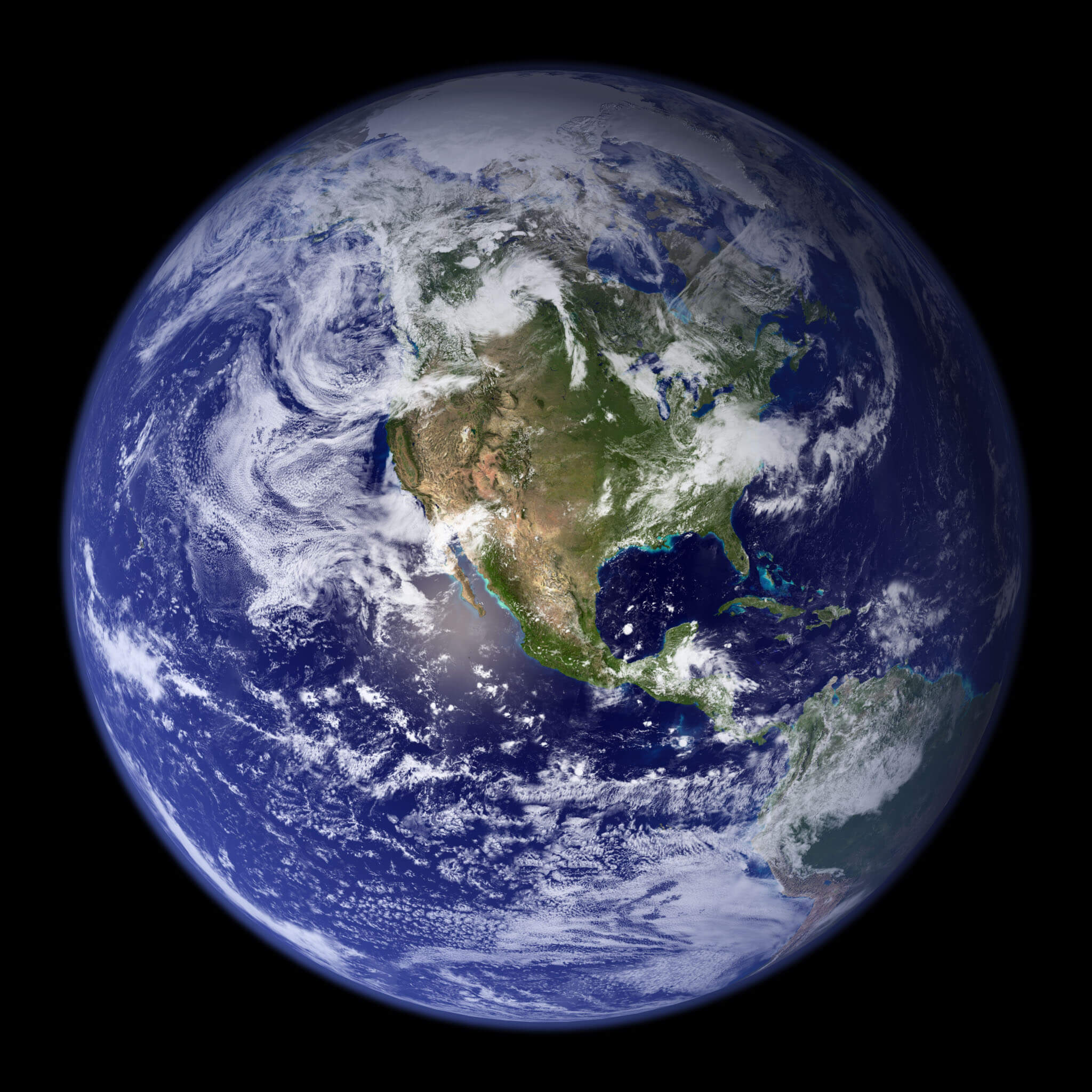
Credit: NASA Goddard Space Flight Center. Image by Reto Stöckli (land surface, shallow water, clouds). Enhancements by Robert Simmon (ocean color, compositing, 3D globes, animation). Data and technical support: MODIS Land Group; MODIS Science Data Support Team; MODIS Atmosphere Group; MODIS Ocean Group. Additional data: USGS EROS Data Center (topography); USGS Terrestrial Remote Sensing Flagstaff Field Center (Antarctica); Defense Meteorological Satellite Program (city lights).
When you think of NASA, you probably think of astronauts, satellites, Mars rovers, and telescopes that study distant planets and far off galaxies.
NASA is a space agency. So, why study Earth?
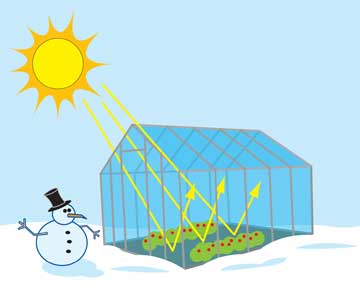
Because Earth is a planet too! In fact, Earth is the planet that NASA has explored the most. And it’s important to keep an eye on the one place in the entire solar system where we can live.
NASA began launching satellites to monitor Earth’s weather in 1960. These satellites changed how scientists forecast the weather. It was also one of the first times that scientists were able to look down at the whole Earth from space.
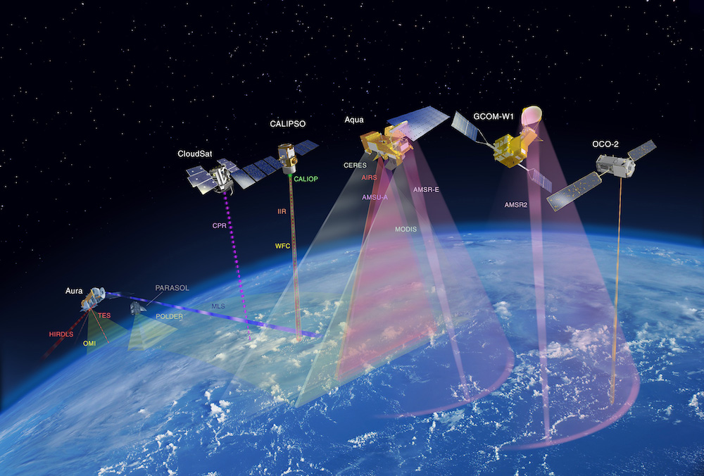
NASA and its international partners operate several Earth-observing satellites that closely follow one after another along the same orbital “track.” This group of satellites is called the Afternoon Constellation, or the A-Train, for short.
Today, NASA’s Earth-observing satellites do much, much more. They are important in helping us understand how our planet works. And the more we know, the better we can cope with the changes that are occurring.
Watch this video to learn how scientists can use new and old pictures to keep track of Earth’s changes over time! Click here to download this video (1920x1080, 485 MB, video/mp4).
With these satellites, we’re trying to answer some very big questions:
- How is Earth changing?
- What's causing these changes?
- How can we better manage our natural resources?
- Can we improve our responses to natural disasters?
- And what does the future hold?
Finding answers to these questions will be critical to human life and civilization as we know it.
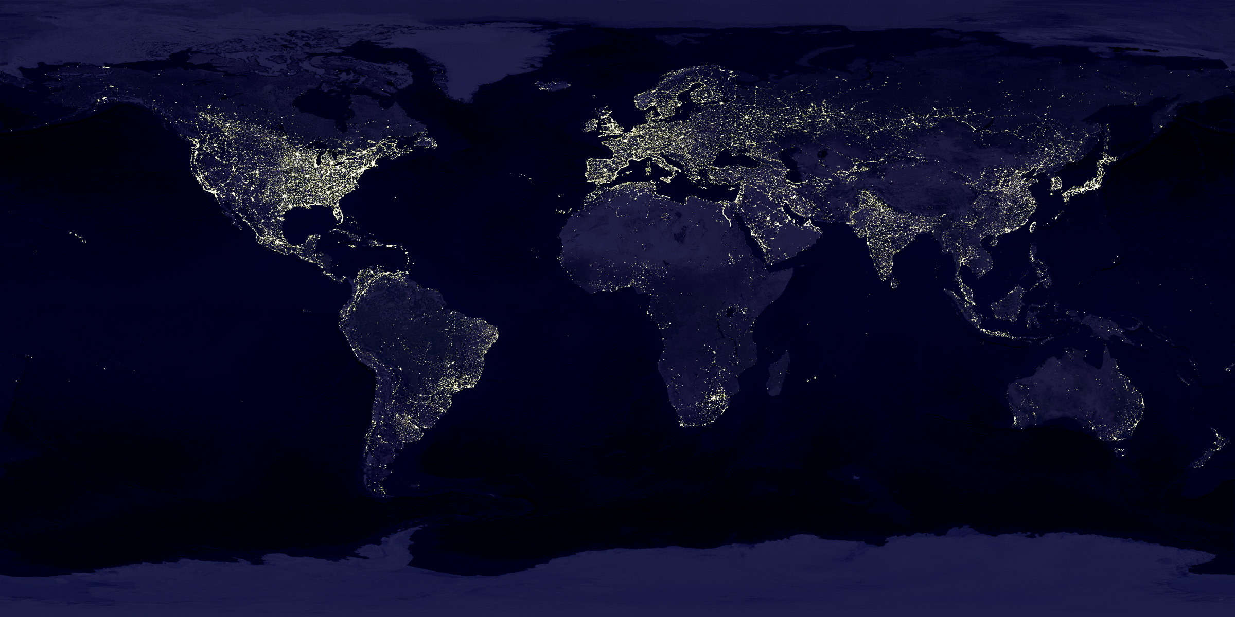
NASA scientists use city light data to map urbanization, or, the growth of populations in cities. Credit: Data courtesy Marc Imhoff of NASA GSFC and Christopher Elvidge of NOAA NGDC. Image by Craig Mayhew and Robert Simmon, NASA GSFC.
Adding to what we learn from satellites, NASA makes regional observations from airplanes and ships. Data is collected on the ground, too. Scientists also use computers to model what’s happening now and in the future with the land, ocean and atmosphere.
Best of all, NASA shares what it learns with researchers all over the world.
Because when it comes to understanding Earth, space is the place to really know a planet. And that’s exactly where NASA is!
Related NASA Missions

Aqua

Aura

CloudSat

CALIPSO
More to explore!

10 Interesting Things About Earth